Arcgis Pro And Esri

ArcGIS Pro and ESRI
Published
to Architecture
on Apr 20, 2024
As a Practice, we have started to work with ArcGIS Pro, the World`s leading GIS Software package.
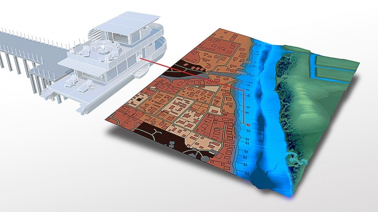
ArcGIS Pro, the powerful single desktop GIS application, is a feature-packed software developed with enhancements and ideas from the ArcGIS Pro user community. ArcGIS Pro supports data visualization; advanced analysis; and authoritative data maintenance in 2D, 3D, and 4D. It supports data sharing across a suite of ArcGIS products such as ArcGIS Online and ArcGIS Enterprise, and enables users to work across the ArcGIS system through Web GIS.
Combine multiple data sources to make maps that are as smart as they are beautiful to look at. Use scientific analytical tools on 2D, 3D, and 4D data to identify patterns, make predictions, and answer questions. Quickly share projects and information within your organization, online, and through mobile apps.
Exploration and Visualisation
Cartography and Design
Imagery
Analytics and Data Science
Data Management
Work sharing
Customisation
New Capabilities
We can Integrate Data from Multiple Sources, Visualise the Data, Edit the Data to suit our Specific Requirements and then share the work with literally anybody, actually the World if we so wish. We can feed data back to ArcGIS that might assist other users in the future and help to update the Data available across the Globe.
Being part of the ESRI Community allows us to present information based on actual World Data Sources, so the results are accurate and unbelievably detailed. For Planning solutions, this is an invaluable tool that will answer questions raised relating to the site, the topography, the surface and consequently, the ground investigation right the way through a process that looks at the environmental impact of what we have designed or plan to build.
One of the great aspect of this Data Source for us is that it has connectivity with Autodesk Products, and the interface between ArcGIS, AutoCAD, Civils 3D, Autodesk Map 3D and Revit is seamless. The combined software packages represent a total game-changer for us in terms of our capabilities an Architectural Designers and what our proposals mean in relation to Real World Data and not just Design, Technical Production and Construction Scheduling.

Tags: #arcgis #gis #esri #map #mapping #qgis #sig #arcmap #geography #a #maps #cartography #geografia #gps #cartografia #geografi #drone #surveyor #gnss #geoprocessamento #mapas #survey #arcgispro #shapefile #mapper #remotesensing #pemetaan #googleearth #jasape, #artwork #engineering #illustration #digital #architect #sketchup #autodeskmaya #designer #cg #archdaily #blender #cnc #adobe #danimation #renderbox #instarender #archilovers #coronarender #zbrush #sketch #inventor #vfx #substancepainter #dmax #arquitetur, #autodesk #d #design #art #autocad #render #architecture #revit #digitalart #dsmax #maya #rendering #autodesksketchbook #cgi #dmodeling #animation #bim #vray #photoshop #drawing #interiordesign #dart #artist #fusion #cad #sketchbook #solidworks #jasa #dmo, #uav #peta #earth #youtube #geospatial #uavmapping #mapa #leica #landsat #helpgis #d #videographer #djimavicmini #mavicmini #fotoudara #supergis #videography #videoudara #droneindonesia #youtuberindonesian #inacorspart #geodetik #topography #meioambiente

